Guide to Algonquin Park Hiking Trails: Top Picks, Practical Information, and Local Tips
Algonquin Provincial Park delivers some of Ontario’s most rewarding hiking, from easy lakeside strolls to multi-day backcountry treks through 7,600 square kilometers of wilderness. You’ll find trails for every ability level, each offering genuine chances to spot moose, black bears, and loons against a backdrop of ancient forest and crystal-clear lakes. Whether you’re planning a quick afternoon excursion along the Highway 60 corridor or a week-long backpacking adventure into the park’s remote interior, Algonquin’s trail network provides access to landscapes that have drawn outdoor enthusiasts for over a century.
The park’s reputation as a hiking destination rests on variety and accessibility. Day hikers can tackle 19 established trails ranging from 1 to 11 kilometers, while backpackers have access to six overnight trails covering up to 88 kilometers. Each season transforms the experience: spring brings rushing waterfalls and migrating birds, summer opens high lookouts with sweeping views, fall paints the hardwood forests in brilliant reds and golds, and winter turns popular routes into snowshoe and cross-country ski trails.
That said, conditions change rapidly here, and current closures affect some routes. The Highland Backpacking Trail remains closed in 2026 following the permanent removal of the Madawaska River bridge in 2025, though a re-route has been posted. Whiskey Rapids Trail is currently closed due to flooding. These temporary setbacks leave plenty of excellent options available, and the trails that are open reward hikers with the kind of authentic wilderness encounters that make Algonquin a standout destination among North American parks.
Why Hike Algonquin Park
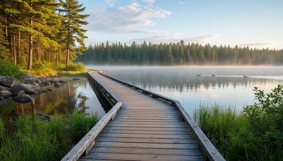
Algonquin Park earns its reputation as Ontario’s premier hiking destination through a rare combination of authentic wilderness and genuine accessibility. Located just three hours from Toronto and 2.5 hours from Ottawa, the park delivers experiences that typically require far more remote travel: dawn encounters with bull moose browsing wetland shallows, the haunting call of loons echoing across mist-covered lakes, and ridge-top views stretching across endless hardwood forest.
The trail network spans every experience level. First-time wilderness hikers find confidence on well-marked interpretive loops with boardwalks and lookout platforms, while seasoned backpackers tackle multi-day circuits through rugged backcountry. This diversity makes Algonquin ideal whether you’re testing your interest in guided outdoor trips or planning your tenth solo expedition.
What truly distinguishes Algonquin is its wildlife density within accessible terrain. The park’s 7,653 square kilometres support one of Ontario’s healthiest moose populations, thriving black bear communities, and over 260 bird species. Trails wind past beaver ponds, through old-growth maple stands ablaze with fall color, and along ancient rock ridges shaped by glaciers. You’ll cross ecosystems ranging from boreal spruce bogs to southern hardwood forests, often within a single hike.
The geology adds drama beyond typical woodland walking. Trails climb Precambrian Shield outcrops offering sweeping panoramas, descend into canyon corridors with 100-meter cliffs, and traverse terrain marked by billion-year-old rock formations. Whether you’re seeking a two-hour nature walk or a week-long backcountry journey, Algonquin’s trails deliver genuine wilderness character without requiring expedition-level logistics.
Top Algonquin Park Hiking Trails
1. Mizzy Lake Trail
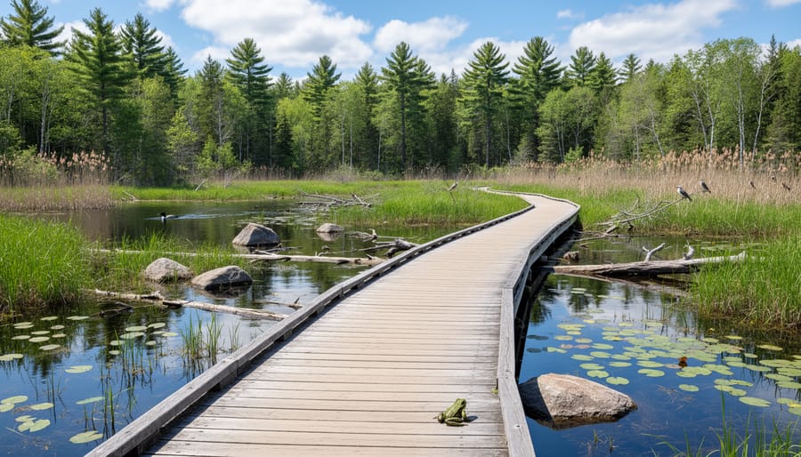
This 11-kilometre loop stands out as Algonquin’s premier wildlife viewing trail, winding through nine distinct ponds and wetland areas where moose, beavers, and waterfowl gather. The Mizzy Lake Trail details reveal extensive boardwalk sections that keep your boots dry while crossing boggy terrain, making this a surprisingly manageable trek despite the 11-kilometre distance. You’ll encounter active beaver dams, open marshes that attract moose during early morning hours, and quiet lake shores perfect for spotting loons and herons.
Photographers love this trail because the variety of wetland environments creates multiple opportunities for capturing wildlife in different settings within a single hike. Bring binoculars and patience; the slow pace required for wildlife observation means most hikers take four to five hours to complete the loop. The terrain is relatively flat with minimal elevation gain, earning it a moderate difficulty rating based on distance rather than technical challenge.
Expect muddy conditions even during dry spells, particularly around pond edges where animals create well-worn paths to the water. The trail’s remote location means fewer crowds than cliff-top destinations, increasing your chances of spotting wildlife undisturbed. Dawn and dusk offer the best moose sightings, though starting too early means navigating dim forested sections before reaching the first wetlands.
2. Centennial Ridges Trail
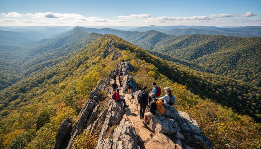
Centennial Ridges Trail delivers some of the most dramatic scenery in Algonquin Park through a demanding 10 km loop that rewards experienced hikers with sweeping panoramic vistas. The trail climbs steadily through mixed forest before opening onto exposed granite ridges that offer breathtaking views across endless forests, shimmering lakes, and distant rolling hills.
The route gains roughly 200 meters in elevation through rocky, uneven terrain that requires solid footing and basic scrambling skills in several sections. Multiple lookout points along the ridgeline provide natural rest stops where you can scan the wilderness canopy stretching to the horizon. On clear days, you’ll see layers of forested ridges fading into blue distance, with glimpses of water bodies nestled between the hills.
What makes this trail exceptional is the extended time spent traversing open ridgetops rather than brief summit views. You’ll spend a significant portion of the hike walking along exposed granite with 180-degree sightlines, creating an alpine-like experience rare in Ontario hiking. The contrast between dense forest ascents and wide-open ridge sections adds variety that keeps the challenging distance engaging.
Plan for four to five hours to complete the loop at a comfortable pace with photo stops. The exposed sections become particularly hazardous in high winds, thunderstorms, or icy conditions, so check weather forecasts carefully and be prepared to turn back if conditions deteriorate. Bring plenty of water since there are no reliable sources along the ridges, and wear sturdy boots with ankle support for the rocky terrain.
3. Track and Tower Trail
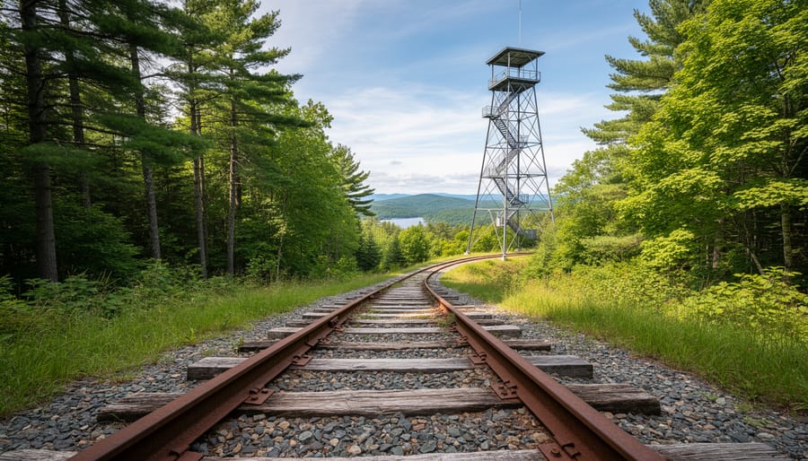
Track and Tower Trail offers a unique journey through Algonquin’s logging history, following an abandoned railway bed before climbing to a restored fire tower with commanding views. This 7.7 km loop takes most hikers three to four hours, making it an excellent half-day option for families with older children ready for a moderate challenge.
The trail begins along the former railway corridor that once transported timber from the park’s interior. These flat, wide sections provide easy walking and opportunities to spot wildlife along the forest edges. The path then transitions to hillier terrain as you approach the fire tower, where a steeper climb rewards your effort with panoramic vistas across the forested landscape. From the tower platform, you’ll see the extent of Algonquin’s wilderness stretching in every direction, a perspective that connects you to the park’s fire management history while offering prime photography angles.
The moderate difficulty comes primarily from the tower climb itself and some uneven terrain rather than sustained elevation gain. Children who can handle a few hours of hiking will enjoy the variety of landscapes and the tangible goal of reaching the tower. Bring water and snacks for a break at the summit, where you can spot lakes glinting through the tree canopy below.
4. Booth’s Rock Trail
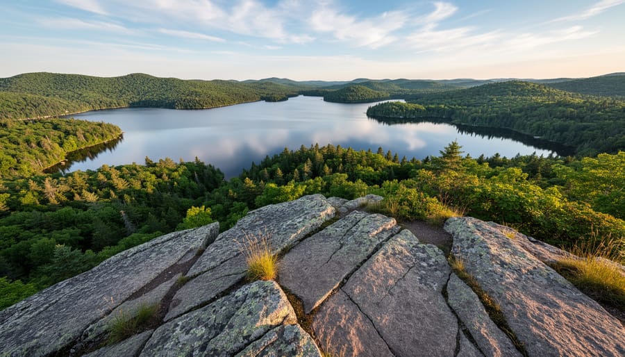
This 5.1 km loop delivers one of Algonquin’s most rewarding view-to-effort ratios, making it a favourite among hikers who want spectacular scenery without the commitment of longer, more strenuous routes. The trail winds through mixed hardwood forest before ascending moderately to Booth’s Rock, a dramatic cliff-top lookout that offers sweeping panoramas across Rock Lake and the surrounding wilderness.
The climb is steady but manageable for most hikers with reasonable fitness. You’ll gain roughly 180 meters in elevation, primarily in the final section approaching the lookout. The rocky terrain requires attention to footing, especially after rain, but the trail is well-marked and straightforward to follow. Most people complete the loop in two to three hours, allowing time to linger at the viewpoint.
At the summit, you’re rewarded with expansive views stretching across Rock Lake’s island-dotted surface and the rolling forested hills beyond. The exposed granite outcrop provides multiple vantage points for photography, particularly striking during fall color season when the maple canopy blazes orange and red. The geological features here, ancient Precambrian bedrock sculpted by glaciers, tell the story of Algonquin’s landscape formation over billions of years.
The trail’s popularity stems from its accessibility; it offers a true wilderness vista without requiring backcountry camping skills or full-day commitment, perfect for families with teenagers or visitors with limited time.
5. Barron Canyon Trail
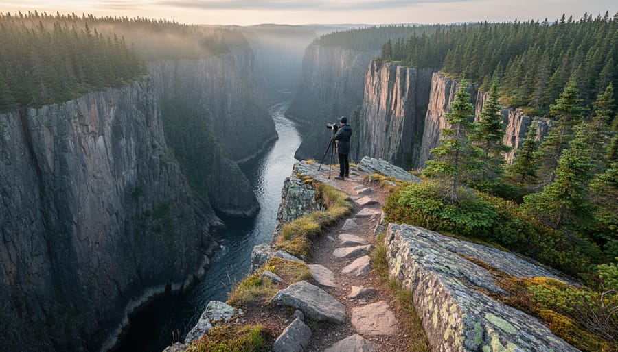
At just 1.5 kilometres, Barron Canyon Trail delivers one of Algonquin’s most dramatic experiences with minimal effort. The easy-to-moderate path leads through mixed forest to the canyon rim, where sheer 100-meter cliffs plunge down to the Barron River below. These towering rock walls, formed by ancient faults in the Canadian Shield, create a microclimate that’s noticeably cooler and windier than the surrounding forest, bring an extra layer even on warm days.
The trail’s accessibility makes it ideal for families and those seeking spectacular scenery without committing to longer, more challenging hikes. Most visitors can complete the out-and-back route in under an hour, though photographers often linger much longer at the multiple viewpoints along the cliff edge. The canyon’s geology attracts ravens and turkey vultures that ride the thermal updrafts, circling at eye level as you peer over the edge. Early morning light illuminates the eastern cliff face beautifully, while late afternoon casts dramatic shadows across the canyon depths.
Exercise caution near the cliff edges, particularly in wet or icy conditions when rocks become slippery. There are no guardrails, and the drop is severe. The trailhead is located off Brigham Lake Road in the park’s northern section, about an hour’s drive from the Highway 60 corridor. This distance from the main visitor area means fewer crowds than southern trails.
6. Lookout Trail
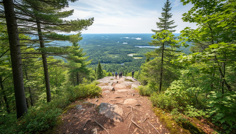
The Lookout Trail delivers exactly what its name promises: sweeping elevated views over Algonquin’s forested landscape from a rocky outcrop perched above the Highway 60 corridor. This 1.9 km out-and-back trail has served as a gateway introduction to the park for decades, combining manageable distance with genuine wilderness scenery and educational value that helps first-time visitors understand what makes Algonquin ecologically significant.
The trail begins near the Visitor Centre and climbs steadily through a mixed hardwood forest dominated by sugar maple and yellow birch. While the elevation gain is moderate rather than strenuous, expect a sustained uphill walk that takes 45 to 60 minutes to reach the lookout point. The path is well-maintained and clearly marked, making navigation straightforward even for those new to hiking.
Along the route, interpretive signs explain the forest succession patterns, tree identification techniques, and wildlife habitat features you’re passing through. These educational panels transform the climb into an active learning experience about Algonquin’s ecosystem, covering topics from how beaver activity shapes wetland environments to the role of fire in maintaining forest health. It’s this blend of accessible physical challenge and interpretive content that makes Lookout Trail particularly valuable for families with curious children or anyone wanting to build forest literacy alongside cardiovascular fitness.
The payoff arrives at the summit lookout, where a rocky platform opens to panoramic views across forested ridges stretching toward the park’s interior. You’ll see the characteristic patchwork of maple, birch, and conifer stands that defines Algonquin’s transitional forest zone, with distant hills fading into blue haze on clear days. The lookout provides excellent photography opportunities, especially during fall color season when the forest canopy becomes a tapestry of crimson, orange, and gold.
7. Western Uplands Backpacking Trail
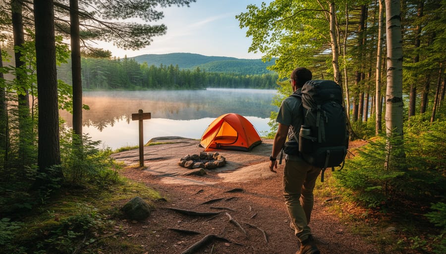
For hikers ready to leave Highway 60’s day-trip crowds behind, the Western Uplands Backpacking Trail delivers authentic wilderness solitude across 32.5 km of rugged Ontario backcountry. This multi-day loop demands strong navigation skills and self-sufficiency, you’ll cross rocky ridges, wade through wetlands, and navigate unmarked sections where cairns and blazes require careful attention. The terrain’s challenging character keeps traffic light, meaning you might encounter only a handful of other backpackers across a three-day trip.
The trail strings together five designated backcountry campsites, each offering basic tent pads and thunderbox outhouses but no water treatment or bear boxes. You’ll need to carry a filtration system and hang your food properly. Sites perch near small lakes and ponds, though some require short bushwhacks off the main route to reach. Most hikers tackle the loop in two to three days, covering roughly 10-15 km daily depending on pace and camp location.
This route operates independently from the now-closed Highland Backpacking Trail, Western Uplands remains fully accessible and maintained for 2026. You’ll need an overnight backcountry camping permit purchased through Ontario Parks’ reservation system, which opens in January for the coming season. Sites fill quickly for fall weekends when bug pressure drops and forest colors peak. Winter camping is technically possible but requires winter survival expertise given the route’s remoteness and minimal traffic.
Pack for self-rescue: cell service is non-existent throughout, and you’re genuinely on your own once you leave the trailhead.
Current Trail Conditions and Closures for 2026
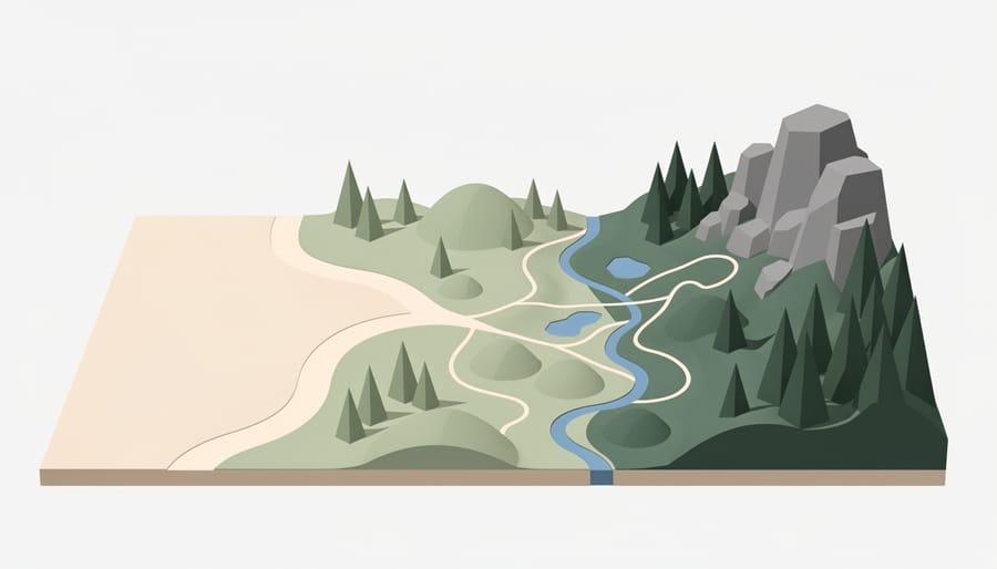
Before setting out on your Algonquin adventure, check current trail status to avoid disappointment. Several significant closures affect the 2026 hiking season. The Highland Backpacking Trail remains closed following the permanent removal of its bridge over the Madawaska River in June 2025. While a re-route has been posted for those familiar with backcountry navigation, this 35 km trail is no longer accessible as originally designed. The Highland trail closure notice provides updated routing information for experienced hikers.
Whiskey Rapids Trail has also been closed due to flooding, making it inaccessible until further notice. The historic Highview Ranger Cabin is closed throughout 2026 for essential repairs and maintenance work.
Beyond these specific closures, Algonquin’s trails demand respect for changing conditions. Prepare for wet, icy, snowy, and muddy terrain depending on the season. Spring brings heavy runoff and trail flooding, while early winter and late fall can leave paths icy and treacherous. Park staff may close the Highway 60 gate and trailhead parking lots during unsafe conditions such as severe storms or unstable ice. Always check the Ontario Parks website for real-time alerts before you travel, and build flexibility into your plans in case your first-choice trail is temporarily inaccessible.
Practical Hiking Information
Getting to Algonquin Park
Algonquin Park’s Highway 60 corridor provides straightforward access from Ontario’s major urban centers. From Toronto, the drive takes approximately three hours heading north via Highway 400 and Highway 11, then west on Highway 60. Ottawa visitors can reach the park in about 2.5 hours traveling west along Highway 417 and Highway 17, then south on Highway 60. The East Gate marks the park’s eastern entrance, while the West Gate sits on the opposite end of the corridor.
Most popular trailheads line Highway 60 between the two gates, with dedicated parking lots at each trail entrance. Spaces fill quickly during peak periods, particularly on fall weekends when leaf-peepers flood the region and summer holiday weekends when campers and hikers converge. Arriving before 9 AM significantly improves your chances of securing a spot near your chosen trail.
During hazardous weather, park officials close and lock the gate at Highway 60 and trailhead parking lots for safety. Check current conditions before leaving home, especially during spring ice melt and after heavy storms. Winter visitors should confirm road and parking access, as snow removal priorities vary throughout the season.
When to Hike
Timing your Algonquin hike significantly impacts your experience. Fall draws the largest crowds for spectacular foliage, with maple forests ablaze in crimson and gold from late September through early October. Expect temperatures between 5°C and 15°C and approximately 11 hours of daylight, but also prepare for packed trailheads and parking challenges.
Spring (April-May) brings muddy trails as snow melts and wildlife emerges, with temperatures ranging from 0°C to 15°C. Blackflies arrive in late May, making this season less popular despite the solitude it offers. Summer (June-August) means lush greenery, warm temperatures of 15°C to 25°C, and the longest daylight hours (up to 15 hours), but also intense mosquitoes and blackflies that peak through July.
| Season | Temperature Range | Key Considerations | Pack Essentials |
|---|---|---|---|
| Spring (Apr-May) | 0°C to 15°C | Muddy trails, emerging wildlife, blackflies late May | Waterproof boots, bug spray, layers |
| Summer (Jun-Aug) | 15°C to 25°C | Peak bugs, busy weekends, lush trails | Heavy bug protection, sunscreen, water |
| Fall (Sep-Oct) | 5°C to 15°C | Peak colors late Sept-early Oct, largest crowds | Layers, camera, early arrival plan |
| Winter (Nov-Mar) | -15°C to -5°C | Snowshoes required, short days, total solitude | Microspikes, warm layers, headlamp |
Winter hiking (November-March) rewards hardy adventurers with pristine silence and frozen landscapes. Temperatures plunge to -15°C to -5°C with just 9 hours of daylight in December, requiring snowshoes and serious cold-weather preparation. Trails can experience closures during unsafe icy or snowy conditions, with gates locked at Highway 60 trailheads when necessary.
Permits and Fees
All visitors to Algonquin Park hiking trails must purchase a day-use permit before entering. For 2026, daily vehicle permits cost $21 per vehicle, while single-day permits for individuals arriving by motorcycle, bicycle, or on foot are $12.50 per person. These permits are valid from the date of purchase through midnight on the day purchased and grant access to all day-use trails along the Highway 60 corridor.
Purchase your permit at the East Gate or West Gate when entering the park, online through the Ontario Parks reservation system, or at select authorized retailers in nearby communities before arrival. Arriving with a pre-purchased permit can save time during peak summer and fall weekends when gate lines extend.
Backcountry camping on multi-day trails like Western Uplands requires separate overnight permits. These cost $14.50 per person per night and must be reserved in advance through the Ontario Parks website, especially during popular seasons. The reservation system opens in January for the upcoming season, and prime autumn dates book quickly. Your backcountry permit includes camping at designated interior sites only and requires you to follow Leave No Trace principles and proper food storage protocols.
Local Tips for Algonquin Hiking Success
Wildlife Viewing Strategies
Algonquin offers exceptional wildlife viewing opportunities if you know when and where to look. Moose are most active during dawn and dusk, particularly around wetlands where they feed on aquatic vegetation. Mizzy Lake Trail provides prime moose-spotting terrain with its nine ponds and boardwalk sections that keep you quiet and positioned near their preferred feeding areas. The Highway 60 corridor also delivers consistent sightings, especially in roadside wetlands during early morning hours in May and June.
Bring quality binoculars to observe animals from a safe distance, at least 30 meters for moose and bears, farther if possible. If you encounter a black bear, remain calm, speak in a low voice, and back away slowly without running. Never approach or feed wildlife, no matter how cooperative they seem for photos. Store all food in bear-proof containers or your vehicle.
Loons frequent the lakes along most trails, while beavers work their dams throughout the park. White-tailed deer appear along forest edges, particularly near the Lookout Trail and Track and Tower Trail. Patient, quiet hikers increase their odds dramatically, rushing through simply alerts animals to your presence and sends them deeper into cover.
Essential Gear and Safety
Algonquin’s backcountry demands proper preparation. Trails can shift from well-maintained paths to muddy, root-strewn challenges within minutes, and the park’s remote nature means you’re often hours from help.
Start with waterproof hiking boots, not just water-resistant sneakers. Algonquin’s trails hold moisture long after rain stops, and even summer hikes can involve sloshing through boggy sections. Pair them with moisture-wicking socks and consider gaiters during spring mud season or after heavy rainfall.
Layered clothing adapts to Algonquin’s unpredictable weather. Mornings might start crisp at 10°C, climb to 25°C by midday, then plunge as clouds roll in. Pack a moisture-wicking base layer, insulating mid-layer, and waterproof shell. Even on sunny forecasts, throw in a lightweight rain jacket, afternoon storms develop quickly over the park’s forests.
Bug protection becomes non-negotiable from May through July. Blackflies peak in late May, mosquitoes swarm through June and July. Bring DEET-based repellent (30% or higher), a head net for particularly bad stretches, and long sleeves in breathable fabric. By August, bug pressure drops significantly.
Your essential pack should include:
- Trail map from the visitor center (cell service is unreliable for GPS)
- Bear-proof food container or bag for all scented items
- First aid kit with blister treatment and any personal medications
- Headlamp or flashlight, even for day hikes that might run long
- Whistle for emergency signaling
- Fire starter and emergency shelter for backcountry trips
- Water filter or purification tablets (treat all natural water sources)
Navigation deserves special attention. Download offline maps before you arrive, since large sections of the park have zero cell coverage. The visitor center sells detailed topographic trail maps, worth every dollar when you’re trying to navigate junctions on the Western Uplands loop. A compass and the skill to use it provide backup when technology fails.
Carry bear-proof storage for anything with a scent: food, toiletries, even lip balm. Black bears are common throughout Algonquin, and proper food storage protects both you and the wildlife. For day hikes, a bear-proof bag works fine; overnight trips require canisters available for rent at park gates.
Avoiding Crowds
Algonquin’s popularity peaks on summer weekends when trailhead parking lots fill by mid-morning and popular routes like Booth’s Rock and Centennial Ridges see steady foot traffic. Arriving before 8 a.m. gives you first access to parking and quieter trails, especially during July and August. Weekdays dramatically reduce crowds, even popular trails feel peaceful Tuesday through Thursday.
For genuine solitude, tackle the Western Uplands Backpacking Trail. Its 32.5 km length and backcountry permit requirement keep casual hikers away, offering wilderness immersion that day-use trails can’t match. Mizzy Lake Trail also sees lighter traffic midweek despite its wildlife appeal.
Shoulder seasons transform the experience. Late May brings emerging leaves and migrating birds with minimal visitors, though trails stay muddy and bugs arrive. Late October offers vibrant fall colors past peak tourist season, crisp temperatures, and no insects, just prepare for shorter daylight hours and possible early snow. Both periods deliver Algonquin’s beauty without the crowds, provided you’re ready for variable conditions.
Frequently Asked Questions
Are there still questions about hiking Algonquin? Most visitors wonder about skill requirements and what’s allowed on the trails before they commit to the drive.
Are Algonquin trails suitable for beginners?
Yes, several trails work well for beginners, including Lookout Trail and Barron Canyon Trail, which offer manageable distances under 2 km with rewarding views. Start with these shorter options to gauge your comfort level before tackling longer loops like Mizzy Lake or Centennial Ridges.
Can I bring my dog on Algonquin hiking trails?
Dogs are not permitted on any trails within Algonquin Provincial Park to protect wildlife and maintain the wilderness experience. Service animals are the only exception with proper documentation.
Is the water safe to drink from lakes and streams?
Never drink untreated water in Algonquin Park due to beaver fever (giardiasis) and other waterborne parasites. Carry sufficient water for day hikes, or bring a proper filtration system for backcountry trips where you need to source water from lakes.
How do I know if my skill level matches a trail?
Check the trail distance, elevation gain, and terrain description at the visitor center or online before you start. A good rule: if you can comfortably walk 5 km on flat ground, you can handle most beginner trails, but rocky routes like Centennial Ridges demand previous hiking experience and solid fitness.
For overnight adventures, planning overnight routes requires advance permit reservations, especially during peak fall color weeks when backcountry sites fill months ahead. The permit system operates similarly to popular campgrounds, so apply the same camping booking tips you’d use elsewhere: reserve early, have backup dates, and understand the cancellation policy. Western Uplands Backpacking Trail remains open for multi-day trips in 2026, though the Highland Backpacking Trail closure means fewer overnight loop options this season.
Algonquin Park stands out among Canadian wilderness destinations because it delivers authentic backcountry experiences without requiring extreme skill or multi-day commitments. Whether you’re tackling the challenging ridge-top views of Centennial Ridges, searching for moose along Mizzy Lake’s boardwalks, or introducing kids to hiking on the Lookout Trail, you’ll find options that match your abilities and available time.
Before you head out, check current trail conditions, closures like the Highland Backpacking Trail and Whiskey Rapids affect access, and seasonal factors from spring mud to winter ice change what preparation you’ll need. Pick trails suited to your fitness level rather than overreaching, pack proper gear for Ontario’s variable weather, and give yourself extra time if you’re hoping for wildlife encounters.
The park’s combination of accessibility from major cities, well-maintained trail infrastructure, and genuine wilderness character makes it an ideal testing ground for building hiking skills or simply reconnecting with nature. Respect the environment, prepare for changing conditions, and you’ll discover why generations of hikers return to these forests, ridges, and wetlands year after year.