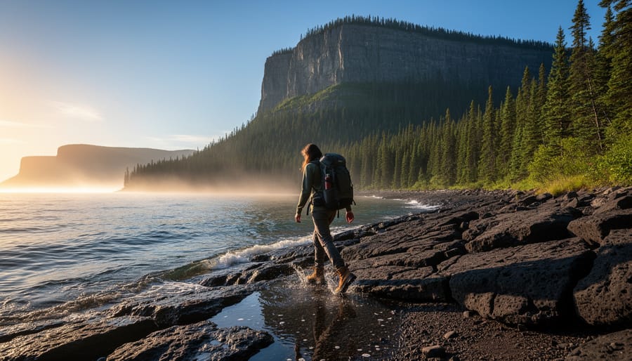
Guide to Sleeping Giant State Park Hiking Trails: Top Routes, Practical Information, and Local Tips
Sleeping Giant Provincial Park delivers more than 100 kilometers of hiking trails across 24,400 hectares of rugged Canadian wilderness, where the dramatic cliffs of the Sibley Peninsula rise from Lake Superior’s north shore. Located approximately 35 kilometers south on Highway 587 from Thunder Bay, Ontario, this destination offers everything from family-friendly nature walks to the challenging Top of the Giant Trail, a 6.6-kilometer round-trip climb that rewards hikers with breathtaking panoramic views from atop the famous sleeping giant formation.
The park earns its name from the distinctive profile visible from Thunder Bay, where the peninsula’s cliffs resemble a resting giant lying on its back. But what makes these trails truly special extends beyond the legendary silhouette. You’ll traverse dense boreal forests, scramble across ancient volcanic rock formations, and follow shoreline paths where black bears and moose frequently appear during dawn and dusk hours. The trail network accommodates every skill level, from beginners exploring the gentle Middlebrun Bay loop to experienced adventurers tackling the full Giant Trail, a demanding route that typically requires six to ten hours to complete.
Winter transforms the landscape completely. The trails remain open throughout the colder months, drawing snowshoers and winter hikers to experience the frozen grandeur of Lake Superior’s ice formations, though preparation requirements shift dramatically when temperatures plunge and snow depths increase. Whether you’re planning a summer backpacking trip or a winter day hike, understanding the specific characteristics of each trail, current conditions, and seasonal challenges will shape your entire Sleeping Giant experience.
Why Sleeping Giant Provincial Park Is Worth the Journey
Sleeping Giant Provincial Park sits on the Sibley Peninsula, jutting into Lake Superior’s northwestern shores, and its name comes from a striking geological profile that resembles a reclining figure when viewed from Thunder Bay. Spanning 24,400 hectares of Canadian Shield wilderness, this park delivers a rare combination of dramatic landscapes, ancient rock formations dating back over a billion years, and ecosystems ranging from boreal forest to rare arctic-alpine plants clinging to clifftops.
What sets Sleeping Giant apart is its sheer variety. The park features over 100 km of trails that cater to everyone from families seeking short forest walks to experienced backcountry hikers tackling multi-day expeditions. You will traverse dense spruce and fir stands, cross rocky ridgelines with sweeping lake views, and descend into quiet valleys where Talus Lake reflects the surrounding cliffs.
Wildlife encounters here are frequent and memorable. Black bears forage along trails during berry season, moose wade through wetland areas near dawn and dusk, and red foxes appear at surprising moments along the coastal paths. Birders spot everything from boreal chickadees to rare peregrine falcons nesting on cliff faces.
The park remains accessible year-round, which distinguishes it from many Canadian wilderness areas that close seasonally. Winter transforms the trail network into snowshoeing and backcountry skiing routes, though conditions vary significantly and require proper preparation.
For adventure seekers exploring North America’s less-crowded destinations, Sleeping Giant offers an alternative to heavily visited parks. It combines the rugged beauty of Superior’s shoreline with genuine backcountry solitude, plus the option to pair hiking with kayaking along the dramatic coastline where trails meet water.
Top Hiking Trails at Sleeping Giant
1. Top of the Giant Trail
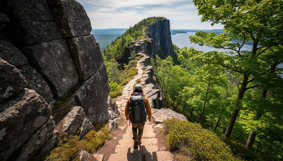
The Top of the Giant Trail stands as Sleeping Giant’s crown jewel, rewarding determined hikers with some of Ontario’s most dramatic cliff-top vistas. At 3.3 km one-way (6.6 km round-trip), this isn’t a casual stroll, you’ll gain significant elevation through challenging terrain that demands both fitness and focus.
Plan for a full day on the trail. Most hikers need 6-10 hours to complete the entire Giant Trail system, which includes the final push to the lookout. The route winds through dense boreal forest before emerging onto the exposed rock formations that give the park its name. When you reach the precipice, you’re standing atop sheer cliffs with sweeping views across Lake Superior’s endless blue expanse.
What makes this trail iconic goes beyond the scenery. You’re hiking the profile of a geological giant, the Sleeping Giant formation itself, with each section revealing different textures of ancient volcanic rock. The final viewpoint sits at the Giant’s chest, offering a perspective that explains why indigenous peoples considered this landscape spiritually significant.
Preparation matters here. Bring more water than you think you’ll need, pack layers for unpredictable weather (conditions can shift dramatically on the exposed sections), and start early to give yourself plenty of daylight. The trail is well-marked but rugged, with steep sections that become treacherous when wet. Solid hiking boots with ankle support are non-negotiable, and trekking poles help on the descent.
Check current trail conditions before you go, weather can close sections temporarily for safety.
2. Sea Lion Trail
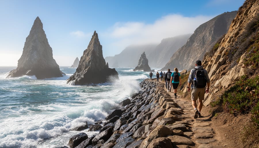
The Sea Lion Trail delivers one of Sleeping Giant’s most distinctive coastal experiences, tracing the park’s rugged shoreline where ancient rock formations meet Lake Superior’s frigid waters. This moderate 5 km route challenges hikers with rocky terrain and occasional elevation changes, but rewards the effort with dramatic cliff-edge views and geological features shaped by millennia of wave action.
The trail’s name hints at its character, you’ll navigate along shoreline sections where weathered rock platforms jut into the lake, creating natural lookout points. These formations provide excellent vantage spots for scanning the water, and if you’re patient, you might spot harbor seals bobbing offshore or catch sight of the occasional black bear foraging along the coast during early morning or evening hours.
Spring through early fall offers the most comfortable hiking conditions, though the trail remains accessible year-round for those prepared for winter’s challenges. Summer brings the calmest lake conditions and warmest temperatures, making it easier to appreciate the coastal scenery without battling wind.
For kayakers exploring the adjacent waters, Sea Lion Trail offers compelling perspective on routes you might have paddled. The shoreline access points also make it possible to coordinate with paddling groups, though most kayakers launch from more established put-ins elsewhere in the park rather than attempting beach access along this trail’s rocky sections.
3. Sawyer Bay Loop
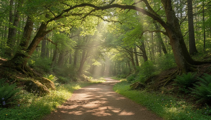
The Sawyer Bay Loop offers intermediate hikers a perfect balance of challenge and accessibility through some of Sleeping Giant’s most varied terrain. This moderate circuit winds through dense mixed forest where the canopy filters sunlight into dappled patterns across the trail, creating an immersive woodland experience that contrasts beautifully with the park’s more exposed coastal routes.
The trail’s moderate elevation changes and well-maintained path make it approachable for hikers with some experience, though you’ll want solid footwear for occasional rocky sections and exposed roots. Plan for 3-4 hours to complete the loop at a comfortable pace that allows time for wildlife observation.
Bird watchers particularly value this route for consistent sightings of boreal species including gray jays, various warblers, and woodpeckers that thrive in the mature forest environment. The quieter sections away from Lake Superior frequently reveal smaller mammals like red squirrels, snowshoe hares, and if you’re fortunate during dawn or dusk hikes, fox moving through their territory.
The loop format means you’ll return to your starting point without retracing your steps, and the trail’s inland position offers reliable conditions even when coastal routes face high winds. Bring binoculars and move quietly through the forest sections for your best chance at wildlife encounters.
4. Talus Lake Trail
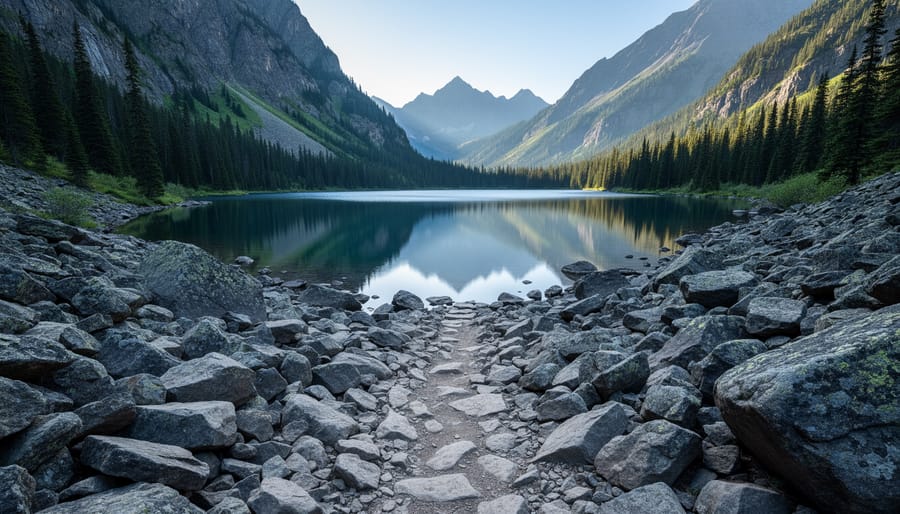
The Talus Lake Trail offers one of Sleeping Giant’s most rewarding backcountry experiences for hikers ready to venture deeper into the park’s wilderness. This approximately 9 km one-way route takes you through dense boreal forest and across rocky terrain to reach the pristine shores of Talus Lake, where the remote setting provides a genuine sense of escape from civilization.
What sets this trail apart is the opportunity for wilderness camping at designated sites near the lake. You’ll need to plan for an overnight trip to fully appreciate the area, as most hikers spend 5-7 hours reaching the lake depending on conditions and pack weight. The trail demands solid backcountry skills, navigation experience, proper gear, and self-sufficiency are essential since you won’t encounter the steady stream of day hikers found on more accessible routes.
The payoff comes at the lake itself: crystal-clear water surrounded by untouched forest, excellent wildlife viewing potential (particularly moose at dawn and dusk), and night skies free from light pollution. Loons call across the water in summer, and you might spot beaver activity along the shoreline. This is true wilderness hiking where you earn every bit of the solitude and natural beauty waiting at the destination.
5. Kabeyun Trail
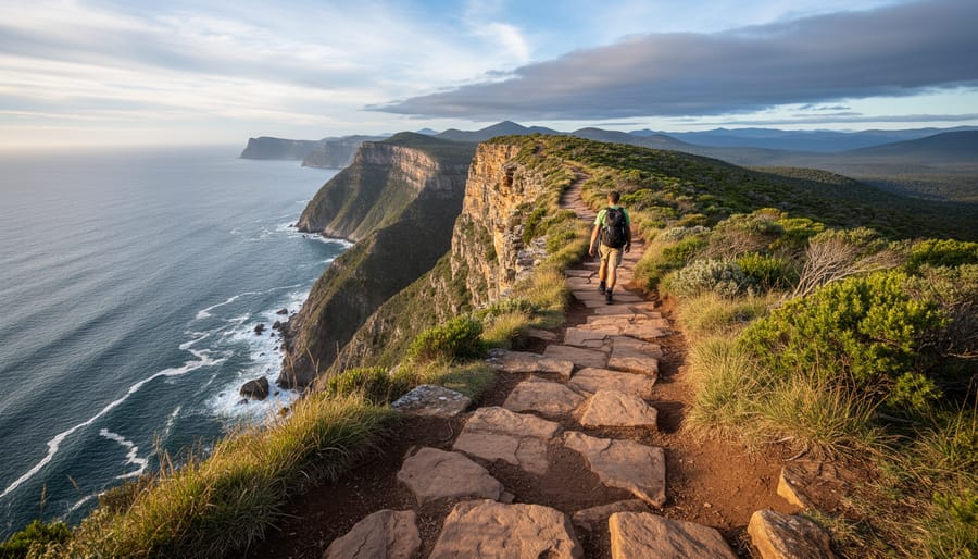
The Kabeyun Trail delivers one of the park’s most dramatic coastal experiences, carving along the cliff edges of the Sibley Peninsula with panoramic views over Lake Superior. This 5-kilometer trail traces the rugged shoreline, offering hikers a front-row seat to the geological forces that shaped Sleeping Giant’s distinctive cliffs and rock formations.
Rated as moderate difficulty, Kabeyun challenges you with uneven terrain and some steep sections near the cliff edge, but the payoff comes in the form of stunning vistas where the forested plateau meets the vast blue expanse of the lake. You’ll navigate through mixed boreal forest before emerging onto exposed headlands where the wind carries the scent of pine and water. Watch for ancient volcanic rock formations and pillow basalt, remnants of billion-year-old lava flows that tell the story of this landscape’s fiery origins.
The trail’s strategic position makes it ideal for creating longer hiking days. Combine Kabeyun with the nearby Sawyer Bay Loop for a full day of exploration, or link it to the Top of the Giant Trail system if you’re chasing an ambitious adventure. Early morning or late afternoon hikes offer the best lighting for photography, when the sun paints the cliffs in warm tones and wildlife activity peaks along the forest edge.
6. Middlebrun Bay Trail
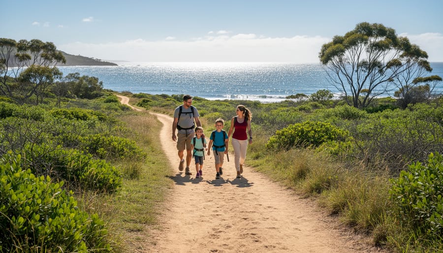
Middlebrun Bay Trail stands out as Sleeping Giant’s most welcoming route for families and novice hikers who want to experience the park without tackling its more demanding terrain. This gentle trail winds through accessible forest paths with minimal elevation change, making it ideal for children, older adults, or anyone building confidence on the trails.
The shorter distance allows most visitors to complete the hike comfortably in under two hours, leaving energy for wildlife watching and learning opportunities along the way. You’ll pass through mixed boreal forest where interpretive signs help identify common tree species like white spruce, balsam fir, and trembling aspen. The understory reveals wildflowers in spring and summer, while berry bushes attract smaller mammals and birds throughout warmer months.
Birding enthusiasts appreciate this trail’s slower pace, which increases chances of spotting woodpeckers, nuthatches, and warblers moving through the canopy. The relatively open forest floor makes it easier to identify animal tracks and signs of wildlife activity, an excellent educational opportunity for young hikers learning to read the forest.
Because the trail stays well-marked and close to developed areas, it offers a safe introduction to Sleeping Giant’s wilderness character without venturing into true backcountry conditions. Pack a field guide to local plants and animals to maximize the learning experience, and take advantage of the forgiving terrain to practice basic navigation skills before attempting the park’s more challenging routes.
7. Sibley Peninsula Trails Network
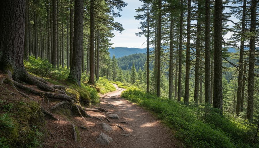
The Sibley Peninsula’s interconnected network transforms Sleeping Giant into a true backcountry destination for hikers seeking multi-day wilderness immersion. With over 100 km of trails weaving through 24,400 hectares of protected landscape, you can design extended routes that combine coastal views, interior forests, and remote lake environments into a single expedition.
Three designated backcountry camping sites anchor multi-day planning: Lehtinen’s Bay, Sawbill Bay, and Tee Harbour. Each provides a base for exploring surrounding trail segments while experiencing genuine wilderness solitude. Reserve campsites well ahead during summer months, as capacity fills quickly with adventurers drawn to this emerging destination.
Navigation demands serious attention on extended trips. Cell service disappears once you leave trailheads, making physical topographic maps and a compass non-negotiable equipment. A GPS device adds redundancy without replacing map skills. Download offline trail maps before arrival, and inform park staff of your intended route and return date.
Plan 15-20 km daily distances for comfortable backcountry pacing, accounting for elevation changes and pack weight. Water sources exist throughout the peninsula, but purification tablets or a filter are essential. Wildlife encounters increase with distance from developed areas, so proper food storage and bear awareness become even more critical in backcountry camps where you’re truly on your own.
Trail Difficulty and What to Expect
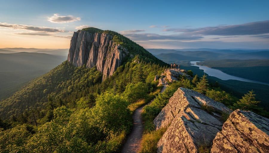
Sleeping Giant’s trail system uses a straightforward classification that helps you match routes to your abilities. The park rates trails as easy, moderate, or difficult based on distance, elevation gain, and terrain challenges. Easy trails like Middlebrun Bay feature gentle grades and well-maintained paths suitable for families. Moderate routes including Kabeyun and Sawyer Bay Loop involve steeper sections, uneven footing, and longer distances requiring reasonable fitness. Difficult trails, primarily the Top of the Giant, demand stamina for sustained climbs, technical scrambling over rock faces, and navigation through rugged backcountry terrain.
| Trail Name | Distance | Difficulty | Typical Time |
|---|---|---|---|
| Top of the Giant | 6.6 km round-trip | Difficult | 6-10 hours (full system) |
| Kabeyun Trail | 8-12 km | Moderate | 3-5 hours |
| Sea Lion Trail | 5 km | Moderate | 2-3 hours |
| Middlebrun Bay | 2 km | Easy | 45-90 minutes |
Terrain varies dramatically across the park’s 100+ km of trails. Expect exposed bedrock requiring careful foot placement, roots and rocks on forested sections, and potentially muddy conditions after rain. Coastal routes face wind exposure and slippery surfaces near water. Winter hiking introduces snow and ice, transforming easy summer paths into challenging treks requiring microspikes or snowshoes.
Match your day hike planning to realistic assessments of your fitness and experience. If you’re comfortable with 4-6 hour hikes involving elevation, moderate trails work well. Save the Top of the Giant for when you’ve built endurance through shorter Sleeping Giant routes first.
Practical Information for Planning Your Visit
Getting There and Park Access
Sleeping Giant Provincial Park sits approximately 35 km south of Thunder Bay along Highway 587. The drive takes you through scenic northern Ontario landscapes, with the turnoff clearly marked from the main highway. Follow the signs pointing toward the park entrance, where you’ll find ample parking at the visitor center.
The main trailheads radiate from the central parking area near park facilities, making it easy to access most routes without additional driving. For trails like Sea Lion and Kabeyun that begin along the coast, follow park roads to designated lots, signage throughout the 24,400-hectare park clearly marks these access points.
If you’re flying in, Thunder Bay Airport is your nearest option, about an hour’s drive from the park. Once you arrive, having your own vehicle is essential since public transportation doesn’t reach this remote area. The roads remain maintained year-round, though winter visitors should be prepared for snow and ice conditions on Highway 587.
Best Times to Hike
Sleeping Giant’s trails are accessible year-round, though each season brings distinct experiences. Summer (June through August) draws the largest crowds, offering warm temperatures and fully accessible trail networks. However, biting insects can be intense during July and early August, so pack bug spray and consider long sleeves for dawn and dusk hikes.
Fall transforms the park into a photographer’s paradise. September and early October deliver brilliant foliage colors, cooler temperatures that make challenging climbs more comfortable, and significantly fewer bugs. Wildlife activity increases as animals prepare for winter, improving your chances of spotting moose and bears.
Winter hiking appeals to experienced adventurers seeking solitude. Trails remain open throughout the colder months, with conditions varying dramatically based on recent snowfall and temperature fluctuations. The park’s snow report tracks 8 open trails totaling 32 km for winter use, though you’ll need snowshoes or microspikes depending on conditions. April 2026 reports noted poor snow quality, illustrating how late-season conditions can deteriorate rapidly.
Spring (May to early June) brings muddy trails and unpredictable weather but rewards patient hikers with rushing waterfalls, migrating birds, and awakening wildlife.
What to Bring
Packing smart separates an enjoyable hike from a miserable slog, especially on Sleeping Giant’s remote trails where help isn’t around the corner. Start with the ten essentials: navigation (detailed topographic map and compass or GPS), headlamp with extra batteries, sun protection, a comprehensive hiking first aid kit knife or multi-tool, fire starter, emergency shelter, extra food, water (at least 2 liters per person for day hikes), and extra clothing layers.
- Navigation: Waterproof trail map, compass, and GPS device or charged phone with offline maps
- Safety gear: Bear spray (accessible on your hip belt), whistle, headlamp, fire starter
- Clothing: Moisture-wicking base layers, insulating mid-layer, waterproof shell, hat, gloves
- Food and water: High-energy snacks, lunch, water bottles or hydration system, water purification tablets
- Overnight additions: Tent, sleeping pad sleeping bag rated for season, cooking system, bear-proof food canister
Ontario’s weather shifts fast, so pack an extra insulating layer even on warm days. Cell service disappears quickly beyond trailheads, making physical maps non-negotiable rather than backup options.
Local Tips for a Safe and Memorable Experience
Wildlife Safety and Viewing Opportunities
Sleeping Giant’s wilderness supports healthy populations of black bears, moose, white-tailed deer, and red foxes. Bears are most active in early mornings and evenings throughout summer and fall, particularly along berry-rich areas near Sawyer Bay Loop and sections of the Sea Lion Trail. Moose frequent wetland zones and lakeshores, with dawn and dusk offering your best photography windows near Talus Lake and Middlebrun Bay.
Make consistent noise while hiking, especially on forested sections with limited sightlines. Travel in groups when possible and talk or clap periodically rather than relying solely on bear bells. If you encounter a bear, remain calm, speak in low tones, and back away slowly without turning your back. Never run. For moose, give them wide berth, they’re unpredictable and surprisingly fast, particularly cows protecting calves in spring.
Pack out everything you bring in. Even small food scraps condition wildlife to approach humans, creating dangerous situations. Check trail reports before heading out, as certain routes may be temporarily closed due to active bear activity or moose calving areas.
Trail Conditions and Navigation
Check the park’s official website or visitor center before setting out, trail conditions can shift dramatically with weather, especially during spring thaw and after heavy rain. The snow report updates regularly (most recently in mid-April showing poor conditions), but conditions improve rapidly as summer approaches and worsen again by late fall.
Carry detailed topographic maps and a GPS device or reliable navigation app with downloaded offline maps. Cell service is extremely limited throughout the park’s 24,400 hectares, so you can’t count on your phone for emergencies or directions once you’re beyond the main parking areas. Mark your trailhead location and keep track of trail junctions, several routes intersect, and it’s surprisingly easy to take a wrong turn in dense forest sections.
Stay on marked paths to protect fragile ecosystems and avoid getting disoriented. Trail markers are generally well-maintained, but winter snow can obscure blazes and footpaths completely. If you’re hiking between November and April, bring snowshoes or microspikes depending on conditions, add extra layers and emergency gear, and allow significantly more time than summer estimates. Winter routes require experience with cold-weather navigation and self-rescue skills.
Combining Hiking with Water Sports
Sleeping Giant’s dramatic coastal cliffs and protected bays create an exceptional setting for combining trail hiking with kayaking adventures. The park’s shoreline offers numerous launch points where you can transition from land exploration to paddling Thunder Bay’s waters, experiencing the iconic rock formations from an entirely different perspective.
Several trailheads provide direct access to coastal areas suitable for launching kayaks. The Kabeyun Trail ends near shoreline access points where experienced paddlers can explore the base of towering cliffs visible from above. Sea Lion Trail similarly connects hikers to launch sites, allowing you to paddle past the distinctive rock formations you’ve just hiked above.
For multi-day adventures, consider planning your itinerary around backcountry campsites accessible by both trail and water. You’ll need to coordinate logistics carefully, many visitors arrange to have kayaks transported to specific pickup points or work with local outfitters who understand the park’s unique geography.
The contrast between perspectives is remarkable: trails reveal sweeping panoramas and forest ecosystems, while kayaking exposes intimate details of geological features, sea caves, and marine wildlife. This dual approach demands proper planning for both activities, including weather monitoring for safe paddling conditions and appropriate gear for each pursuit.
Common Questions About Sleeping Giant Hiking Trails
Which trail is best for beginners?
The Middlebrun Bay Trail offers the most accessible introduction to Sleeping Giant, with shorter distances and gentler terrain. Sawyer Bay Loop is another solid choice for intermediate beginners ready to tackle moderate elevation changes.
Do I need a permit to hike at Sleeping Giant?
Day hiking requires a valid park vehicle permit, which you can purchase at the park entrance. Backcountry camping requires advance reservations and a separate overnight permit, especially during peak summer months.
Is it safe to hike alone, given the wildlife?
Solo hiking is possible but requires extra precautions. Make noise regularly, carry bear bells or other noise-making devices, and always inform someone of your planned route and return time. Black bears and moose inhabit the park, so proper food storage and bear spray are essential.
Can I really hike here in winter?
The trails remain open throughout the winter, though conditions change dramatically. You’ll need snowshoes or microspikes, proper layering for sub-zero temperatures, and navigation tools since trail markers may be snow-covered. Check current conditions before heading out, as reports like the April 2026 update showing poor conditions indicate when trails become challenging.
How long should I plan for the Top of the Giant Trail?
Most hikers take 6-10 hours to complete the full Giant Trail system, which includes the Top of the Giant Trail’s 6.6 km round-trip. Start early to avoid rushing and allow time for breaks at the spectacular lookout points.
Can I combine hiking with kayaking?
Absolutely. The park’s coastal trails connect to launching points for exploring Superior’s shoreline by water. Consider guided kayaking tours for your first paddle, then plan multi-day trips that alternate between trail exploration and coastal paddling for the full Sleeping Giant experience.